
Dunwoody ZIP Code Coverage
Dunwoody's official Address layer contains five valid postal codes. These are city address points, not population or household counts. The dominant code covers much of central, western, and northern Dunwoody, while smaller groups reach Perimeter Center, the eastern corridors, and the Sandy Springs edge. The table reflects municipal GIS data checked against official postal locations.
| ZIP Code | Areas Covered | Post Office | Notes |
|---|---|---|---|
| 30338 | Central, west, north, Village | Dunwoody and Perimeter Center post offices | 15,756 city points; postal city may be Atlanta |
| 30346 | Perimeter Center southeast core | No separate retail station verified | 4,490 city points |
| 30360 | Dunwoody North, Winters Chapel, eastern corridors | Serving station not confirmed | 3,364 city points |
| 30350 | Tiny northern fringe | North Springs and Northridge | 154 city points; Sandy Springs postal label possible |
| 30328 | Hunters Branch and Hunters Point sliver | Sandy Springs | Only 11 city points |
No box-only or unique institutional ZIP appears in the city layer. Some 30338 stations offer post office boxes, but that does not make the code box-only. No official split or realignment history was found. This ZIP code directory therefore uses present official data and does not invent a historic cutoff.
Dunwoody ZIP 30338
ZIP 30338 dominates the official city address file with 15,756 points. It spans Dunwoody Village and many established central, western, and northern neighborhoods. The Dunwoody Post Office is at 1551 Dunwoody Village Parkway. The Perimeter Center Post Office at 4707 Ashford Dunwoody Road also uses 30338.
Postal city text can still read Atlanta. That label routes mail and does not decide whether an address is within Dunwoody. Check the city limit layer before choosing a city records office. County property, deeds, probate, and major court records remain DeKalb records regardless of the postal-city label.
Modern ZIP geography also sits on an older local pattern. The 9.8-mile Roswell railroad opened in 1881, was converted to standard gauge in 1903, and ended service in 1921. Its crossroads helped shape early settlement around what became Dunwoody Village, now within the broad 30338 postal area. That history does not turn a railroad-era place name into a current ZIP boundary. It does explain why old newspapers, directories, cemetery records, and deeds may describe a Dunwoody family through a crossroads, land lot, or DeKalb district instead of a five-digit code. When a historical name search reaches that period, use the old place description to find a parcel or legal description first. Apply the current ZIP only after the modern address has been established through city GIS and USPS.
Note: A 30338 mailing label narrows the search area, but municipal GIS decides whether Dunwoody City Hall is the right custodian.
Dunwoody ZIPs 30346 and 30360
ZIP 30346 covers the high-density residential and business core around Perimeter Center. The city layer contains 4,490 address points in that code. Research did not verify a separate retail post office for 30346, so do not infer a station from the ZIP alone. Nearby postal services may use a different code.
ZIP 30360 accounts for 3,364 city address points in eastern and southeastern Dunwoody, toward Dunwoody North, Winters Chapel, and the Peachtree Industrial corridor. The exact official station serving every 30360 address was not established. For either code, USPS answers the delivery question and SmartMap answers the city-limit question.
Dunwoody's Smallest ZIP Areas
The northern fringe produces the clearest boundary quirks. ZIP 30350 has 154 Dunwoody address points near the Sandy Springs line. North Springs and Northridge postal stations serve that postal geography, and a Sandy Springs mailing label can still belong to a parcel inside Dunwoody.
ZIP 30328 is smaller still. The official layer returned only eleven points, including examples on Hunters Branch Drive and Hunters Point. It is a useful geography check because a broad ZIP search would mostly return addresses outside the city. Confirm each candidate point before attaching Dunwoody municipal records to it.
Geography check. Five ZIPs appear in official city data, but 30328 contributes only eleven address points inside Dunwoody.
Search Dunwoody by ZIP Code
The city Address REST layer accepts an exact Zip query and can return official address points with parcel, subdivision, common-name, city, and status fields. Results are capped at 1,000 records per response, so large searches require pagination. Neither the assessor front page nor ordinary My Voter Page had a verified public ZIP filter during research.
- Check a complete delivery address in the USPS lookup. Save the exact result, including any unit.
- Open Dunwoody SmartMap and confirm that the address point lies inside the city boundary.
- Query or browse the city Address layer by exact ZIP, paging results when the response exceeds 1,000 points.
- Move from the address point to the parcel ID, then use the appropriate county or city record.
A lawful county voter extract may be ordered by permitted geography, but Georgia My Voter Page is only an authenticated self-lookup. Once a ZIP has narrowed the area, use the Dunwoody street directory for street-level parcel and address work.
Verify Dunwoody ZIP Records
The USPS address lookup is the authority for the delivery ZIP. The city SmartMap carries official addresses and city limits, plus parcels, voting districts, zoning, and places of interest. Each tool settles a different issue.
| Tool or field | What it establishes |
|---|---|
| USPS by address | Current delivery ZIP for a complete address. |
| Address layer Zip | Exact postal value stored for an official city point. |
| City and Status | Municipal label and whether the point is active, inactive, or preliminary. |
| ParcelID | Bridge from an address point to the county tax parcel. |
| Subdivision/CommonName | Local context available in the city layer. |
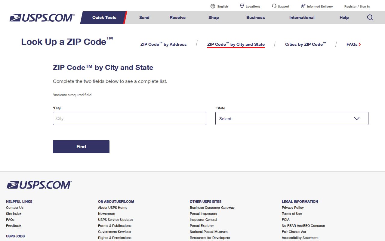
The USPS city-and-state search screen appears below. Use it as an entry point, then verify a specific delivery address rather than assuming that every result lies inside Dunwoody.
Dunwoody ZIP Data Needs Review
The official Address layer returned one malformed value, 03383, alongside the five legitimate codes. That lone row is a data-quality lesson, not a sixth ZIP. Official datasets can contain typing, migration, or status errors, so compare an odd value with USPS and the parcel record before relying on it.
Counts also need labels. The totals are address points, not residents, households, registered voters, or tax parcels. A multi-unit property can be represented differently from a detached home. Preliminary or inactive points may remain in a layer. The ZIP code directory uses these counts only to describe the city's recorded address geography.
Dunwoody ZIPs Versus City Limits
ZIP areas are delivery routes, not municipal borders. An address can carry Atlanta or Sandy Springs as its preferred postal city while its point and parcel lie in Dunwoody. The reverse is also possible: a familiar Dunwoody ZIP extends beyond the city. This matters because City Hall keeps municipal permits and code cases created after incorporation, while DeKalb County keeps deeds, property assessment, probate, and major court files.
- ZIP vs ZIP+4
- The five-digit area routes mail broadly; the added four digits narrow delivery to a smaller segment.
- PO-box ZIP
- A code reserved mainly or wholly for post office boxes. None appears in Dunwoody's official layer.
- Unique ZIP
- A code assigned to one high-volume institution. None was found in the city data.
- Carrier route
- A group of delivery addresses served in one postal route, which is finer than a five-digit ZIP.
The city incorporated on December 1, 2008. That date changed who created city permits and code records, not the postal code or county deed system. Historical metro renumbering in 1892 and 1926 can also break an old address trail. The deed's legal description and parcel identity remain more stable than a mailing label.